Lower data use with Google Maps and more tips

On your way to work, on vacation, or heading to an appointment? Thanks to Google Maps, you’ll always reach your destination (and get back home) without getting lost. The smart app has become an essential part of our smartphones. But how exactly does the popular navigation app work, and how much data does Google Maps use? In this blog, we take a closer look at Google Maps.
The most popular navigation app: Google Maps
Google Maps is the go-to navigation app for Android and iOS, both for smartphones and tablets. But does Google Maps use data? The app uses GPS for navigation, which is great, because GPS itself doesn’t cost any data from your Sim Only data bundle . The app does, however, need internet to download the road maps that get you to your destination. Unless you use one of our tips further down in this article!
Google Maps isn’t just a navigation app: it also shows opening hours of restaurants and other public places. You can read reviews, perfect for checking if that one restaurant is actually worth visiting! If you're online, the app can also show traffic information. Stuck on the road? The app will reroute you, saving you valuable time.
The app is hugely popular because it’s free, comes pre-installed on Android phones, and is very user-friendly. It runs smoothly and quickly, both online and offline.
How much data does Google Maps use?
So, how much data does Google Maps actually use? Good question! It’s useful to know ahead of time how much data an app consumes, so you don’t burn through your bundle too fast. As mentioned, navigating via GPS doesn’t use data, but the road maps do.
To give you an estimation, one hour of driving with Google Maps uses about 20 MB of data (10 MB per half hour). This is an estimate, because the actual amount depends on where you are and how good your signal is. Additionally, the app uses the most data for downloading new map sections during your drive. Driving down a quiet country road with few towns or intersections nearby uses less data. If you want to save data, you can download the maps in advance.
Once maps are downloaded, car navigation also works offline. Good to know: this does not apply to biking or walking routes.
Google Maps data usage: how to avoid using your data
The app doesn’t have to use mobile data. You can save maps offline in advance, with Wi-Fi. That way, your phone doesn’t need to download maps while you’re navigating. This is great because downloading maps won’t cost you data from your Sim Only bundle.
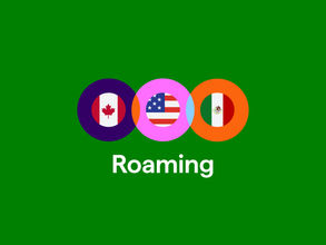
In the Netherlands or the EU, this may not matter as much, since there are no roaming charges . But it’s still a smart way to save data. Outside of Europe, where roaming costs still apply, it will be quite useful, because Wi-Fi use won’t mean you're using your bundle. This prevents extra charges. Another bonus: since your phone doesn’t need mobile internet, your battery lasts longer.
There is one limitation: with Google Maps, you can’t download an entire country at once, only a selected area. But you can save multiple sections offline, so with a little effort you can cover a whole country. Perfect if you want to prep your vacation to the south of France. “Où est la plage?” You’ll already know!
How to save maps offline in Google Maps:
- Open Google Maps.
- Tap your profile picture (or the three lines menu).
- Select 'Offline maps'.
- Tap 'Select your own map'.
- Move the map to the area you want to save offline.
- Tap 'Download'.
- The map will now be saved offline via Wi-Fi.
- You can repeat this as often as you want, as long as your phone has enough storage.
Tips: How to get the most out of Google Maps
Google Maps is incredibly popular for a reason. With just a few taps, your full route is planned. But with some smart settings, you can make the app even more useful. Read our tips to get even more out of Google Maps.
Bicycle-friendly directions
Of course, the Dutch will take their bike if they can. The fastest route, especially in the city, is often by bike. But because of those separate bike paths, the route can differ from the car routes (plus you don't want to end up on the highway). Of course, you can simply view bike paths in Google Maps. Here’s how to see cycling routes:
- Open Google Maps.
- Tap the diamond-shaped icon in the corner.
- Under 'Map details', tap 'Cycling'.
- Bike paths now appear on the map.
Share your live location with Google Maps
If you want, you can share your location live with Google Maps. This way, you can let your partner know what time you’ll be home. For example, if you’re stuck in traffic and your sweetheart is waiting with a romantic dinner, they can see exactly where you are. That way, the food will still be ready right on time! It’s also super handy at a festival , because it makes it easy to find each other again.
Share your live location with Google Maps:
- Open Google Maps.
- Tap on your profile picture in the top right.
- Tap on ‘Share location’.
- Now you can set how long you want to share your location.
- Here you can also choose to share your location through a specific app, or select who can see your live location.
Adding stops to your route
Google Maps knows exactly how to get you from A to B the fastest. But did you know you can also add stops along the way? Perfect if you want to take it easy while on vacation. This way you can drive from one idyllic little town to another, and your route won’t just be highways. Did anyone say road trip?
How to add stops to your route in Google Maps:
- Open Google Maps.
- Search for the place you want to go and choose ‘Route’.
- Tap on the three dots in the top right next to the starting point.
- Tap on ‘Add stop’.
- Now you can add a stop.
- Use the three lines next to a location to move it forward or backward in your route.
- Repeat this until your route is complete!
Always find your parked car (or bike!) right away
Ever lose track of where you parked your car or bike? Google Maps can help. You can set a location as your parking spot. As soon as you park, use this feature. That way, you’ll easily find it later!
How to save your parking location with Google Maps:
- Open Google Maps when you park the car.
- Tap on your location, shown as the blinking blue dot.
- Tap on ‘Save parking’.
- A ‘P’ will now appear at that spot to show where your car is.
Stay on top of your data with Simyo
At Simyo, we don’t want you to run into unexpected costs when you go over the call or data bundle of your Sim Only plan . That’s why we not only send you an SMS when your data is almost used up, but you can also check your data usage anytime in the Mijn Simyo app or via Mijn Simyo .